


Voting Districts not defined, Grand Traverse County, Michigan
About
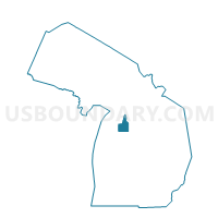
Outline

Summary
| Unique Area Identifier | 596729 |
| Name | Voting Districts not defined |
| County | Grand Traverse County |
| State | Michigan |
| Area (square miles) | 111.03 |
| Land Area (square miles) | 0.00 |
| Water Area (square miles) | 111.03 |
| % of Land Area | 0.00 |
| % of Water Area | 100.00 |
| Latitude of the Internal Point | 44.87253170 |
| Longtitude of the Internal Point | -85.57022950 |
Maps


Graphs
Select a template below for downloading or customizing gragh for Voting Districts not defined, Grand Traverse County, Michigan


Neighbors
Neighoring Voting District (by Name) Neighboring Voting District on the Map
- Voting District 0092534000001, Antrim County, MI
- Voting District 0550020000001, Grand Traverse County, MI
- Voting District 0550020000002, Grand Traverse County, MI
- Voting District 0552380000001, Grand Traverse County, MI
- Voting District 0552380000004, Grand Traverse County, MI
- Voting District 0556334000001, Grand Traverse County, MI
- Voting District 0556334000002, Grand Traverse County, MI
- Voting District 0558034000001, Grand Traverse County, MI
- Voting District 0558034000008, Grand Traverse County, MI
- Voting District 0558034000009, Grand Traverse County, MI
- Voting District 0898034000004, Leelanau County, MI
- Voting Districts not defined, Leelanau County, MI
- Voting Districts not defined, Antrim County, MI
Top 10 Neighboring County Subdivision (by Population) Neighboring County Subdivision on the Map
- Traverse City city, Grand Traverse County, MI (14,482)
- East Bay township, Grand Traverse County, MI (10,663)
- Peninsula township, Grand Traverse County, MI (5,433)
- Elmwood charter township, Leelanau County, MI (4,503)
- Acme township, Grand Traverse County, MI (4,375)
- Suttons Bay township, Leelanau County, MI (2,982)
- Elk Rapids township, Antrim County, MI (2,631)
- Bingham township, Leelanau County, MI (2,497)
- Leelanau township, Leelanau County, MI (2,027)
- Traverse City city, Leelanau County, MI (192)
Top 10 Neighboring Place (by Population) Neighboring Place on the Map
Top 10 Neighboring Unified School District (by Population) Neighboring Unified School District on the Map
- Traverse City Area Public Schools, MI (79,692)
- Elk Rapids Schools, MI (8,621)
- Suttons Bay Public Schools, MI (5,854)
- Northport Public School District, MI (2,000)
- School District Not Defined (Water), MI (243)
Top 10 Neighboring State Legislative District Lower Chamber (by Population) Neighboring State Legislative District Lower Chamber on the Map
- State House District 104, MI (104,139)
- State House District 105, MI (95,524)
- State House District 101, MI (92,671)
Top 10 Neighboring State Legislative District Upper Chamber (by Population) Neighboring State Legislative District Upper Chamber on the Map
Top 10 Neighboring 111th Congressional District (by Population) Neighboring 111th Congressional District on the Map
Top 10 Neighboring Census Tract (by Population) Neighboring Census Tract on the Map
- Census Tract 5501.01, Grand Traverse County, MI (5,934)
- Census Tract 9702, Leelanau County, MI (5,323)
- Census Tract 9706, Leelanau County, MI (5,090)
- Census Tract 5509, Grand Traverse County, MI (4,814)
- Census Tract 5510, Grand Traverse County, MI (4,103)
- Census Tract 5512, Grand Traverse County, MI (3,398)
- Census Tract 5511, Grand Traverse County, MI (3,292)
- Census Tract 9606, Antrim County, MI (3,290)
- Census Tract 5515, Grand Traverse County, MI (3,068)
- Census Tract 5501.02, Grand Traverse County, MI (2,956)